Abandoned Gold Mine
Thursday, July 21, 2016
Rolling Stones Rock Club outing July 16 New Mexico Diamonds
Rolling Stones Rock Club outing took a convoy of 20 vehicles to a mountain in the wilderness where they say the crystals are New Mexico diamonds. Got a baggie full and waiting on Mom to check them with her diamond tester.
Little Bear Mountain
I have been concentrating on Bear Mountain because it is over 8000 ft. Lately I have been hiking Little Bear Mountain. What a fantastic and rugged hike. Mile and a half trail which takes you up over 1500 ft. Little Bear 7800'.
Panoramic from the top of Little Bear Mtn
Mule Deer
Bobwhite Quail
Black Range Fire
On Monday July 11 Pam and I drove to Las Cruces. Its about a 2 hour drive and it was a nice clear day. On our return we noticed what looked like smoke from a fire. We could see it from over 50 miles away and it was in the direction of Silver City. As we got closer it sure was a forest fire across the highway from us on the Black Range. Maybe 20 miles away. You could see the fire planes and helicopters flying around the fire. At night you could see the flames. It was cool and not so cool at the same time. Over 100 fire fighters took 4 days to contain. 200 acres. It was started by a lightening strike the Saturday before and smoldered until Monday when winds picked up and it started flaming. We followed the fire on the New Mexico wildfire app which shows the fires and lists what is being done.
Sunday, July 10, 2016
4th of July and Lake Bill Evans
Pam in the middle of Broadway with Grant County Courthouse in the background
My favorite and highest peak in this immediate area Bear Mountain in the clouds
Same mountain different day, 4th of July in the hood
Random grave site on Bear Mountain
8 point mule deer which came into our yard last night. Still in velvet. Gonna be a monster this year
Can you see the deer looking towards camera
Bill Evans Lake
Friday, July 1, 2016
3 Day Hike (on foot) into the Gila Wilderness Area
3 day hike into the G ila Wilderness area starting at the Loco Mountain Trailhead on trail 702 we hiked 8 miles into the wilderness to Clear Creek camp. The trail crossed Middle Fork River which, along with the other Fork Rivers becomes the Gila River which runs ultimately into the Pacific Ocean because it is on the west side of the Continental Divide. Middle Fork River Canyon is a beauich. Nice way to say bitch. Over 300' rapid descent and ascent that almost stroked me out. All over 7000'. I have a new respect for mules. I wondered why mine was sweating.. I will, within 2 years become an elk hunting guide. The terrain is not for everyone. It can be overwhelming but I love it and can connect with it.
Top of Middle Fork River Canyon on the south side. What you climb down you ultimately have to climb up.
Middle Fork River Canyon
Middle Fork River. This was 4 miles into the hike and was a great place to resupply with water. I consumed over a gallon on the way and got another gallon from the river. I used the Coleman Iodine tablets to treat my water.
What goes down must come up
Blood Blister Canyon. Camp
They dont sell a one man tent so I bought a two kid tent at walmart for 17 bucks. Perfect but you have to sleep diagonally
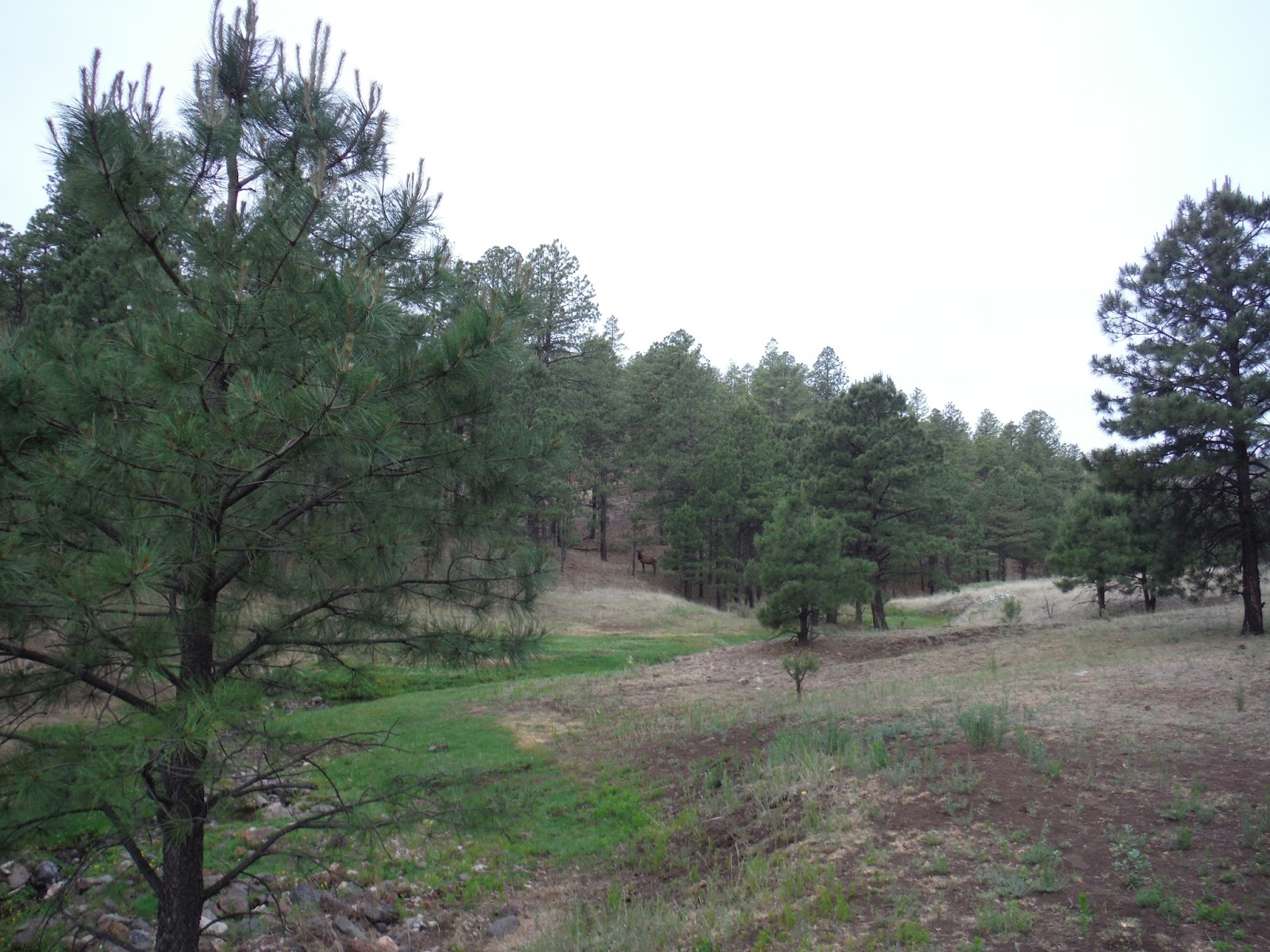
To the right of the elk is out bathroom. Yesterday he is a 4 x 4 in velvet. By hunting season this is at least a 6 x 6 or more. A monster elk.
The guys under the tarp were snoring and the elk was this close.
Some settlers grave along the trail. Seriously. Yes
Aeroplane Mesa. Pam's favorite photo
Next time I hike there has to be someone my age or older so I am not the only one holding up the group. Getting voted off the island.
Subscribe to:
Posts (Atom)